Grade 2 difficulty but no directional signs.
1.2 km (one way) 25 minutes or
allow 50 minutes for the return walk
so that you can read the interpretive signage
alongside the car park at the lake.
The trail commences without fanfare at this "Road Narrows" sign at the northern edge of the village
The trail down the slope is barred by a steel pipe barrier. This is obviously designed to deny access to motor bikes and vehicles but allow recreational walkers to enter.
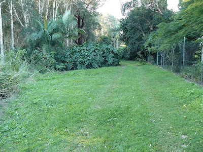
Close to the Tweed Coast Road the residents keep the buffer zone in neatly trimmed condition
While residents are happy to do the work National Parks and Wildlife are rigorous in ensuring that no dogs are allowed to walk this trail. A $300 fine is a fair deterrent.
Fire damage from 2009 fires is still evident but the biodiversity of this region ensures quick recovery
The grasses make a quick recovery
Work on the drainage in this area is almost finished. (July 2012) Pipes have been laid under this area and grass should be regrowing quite soon. This clump of trees will often reveal a koala and credit to NPWS for ensuring these trees were not felled.
The newly laid pipes are directing the water from the Tamarind Avenue area into the Cudgen Nature Reserve
Some pinus species have grown in this region probably regenerated by seed dispersed by birds. The grass understory is home to an amazing variety of finches
The grassed area adjacent to the Lakeside Apartments is private property so I veered slightly north westerly toward Cudgen Lake.
This trail should be discussed with NPWS. There are some bollards ensuring walkers do not continue toward Camp Wolumbin so I went to the edge of the lake and then around the southern shore.
A joy to spend some time with this serenity
A view includes Woolumbin on the clear days
Lake views
The carpark at the end of the Trail has some interpretive signage and its worth going a few extra metres to view the connection from the lake to the Friday Island canal. A wonderful kayaking area.


